Resources
Explore all of our content to learn more about how Ecopia is digitizing the world with AI.

News
Digital Twin
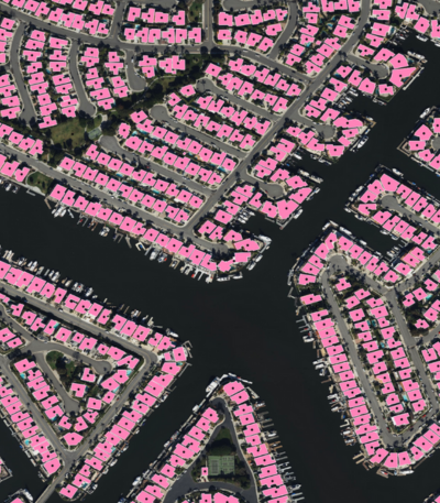
Ecopia AI & Vantor Partner to Map the World in 3D

News
Transportation Planning
Ecopia AI Provides Santa Fe Metropolitan Planning Organization with High-Precision Data to Advance Transportation Planning

Blog
Insurance
Ecopia's Geocoding APIs: Addresses, Buildings, Parcels, & More
Blog
Insurance
Rewriting the Rules: Data Innovation and the Next Era of P&C Insurance
Blog
Insurance
Measuring & Understanding Building Change Year Over Year
Blog
Digital Twin
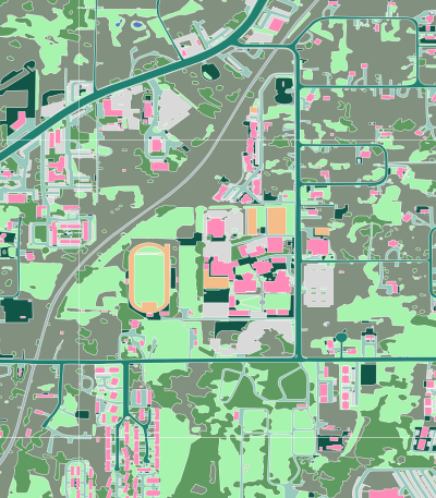
Top 5 Applications for 3D GIS Data

News
Insurance
Titan Flood Selects Ecopia AI’s Building-Based Geocoding to Power Advanced Geospatial Analysis
News
Digital Twin
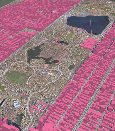
Ecopia AI Delivers Off-the-Shelf 3D Land Cover Data Across Canada’s Largest Cities

News
Climate Resilience
The California Department of Forestry and Fire Protection Selects Ecopia AI to Deliver High-Precision Mapping Data to Support Fire Mitigation and Response
News
Digital Twin
3D Land Cover Data from Ecopia AI Now Available for Instant Access Across 400 US Cities
Blog
Insurance
Levels of Precision in Geocoding: A Comprehensive Guide